The Firstplanit Geographic Information System (GIS) enables users to understand the air, noise, heat, and flood risk impact for a building site all in one place. If you want to learn how to assess the environmental risks of a building’s location on the occupants and the building, follow these simple steps.
Step 1
Visit our landing page and select “Assess Site Risks” to be redirected to our free site risk feature.
Step 2
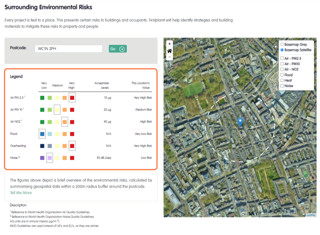
Enter the postcode of your project area. Note that this feature is only currently available for UK postcodes.
Step 3
The site legend allows you to understand the impact of each risk for your site regarding air quality, flood risk, overheating, and noise pollution. The impact of these risks has been graded from very low to very high.
Step 4
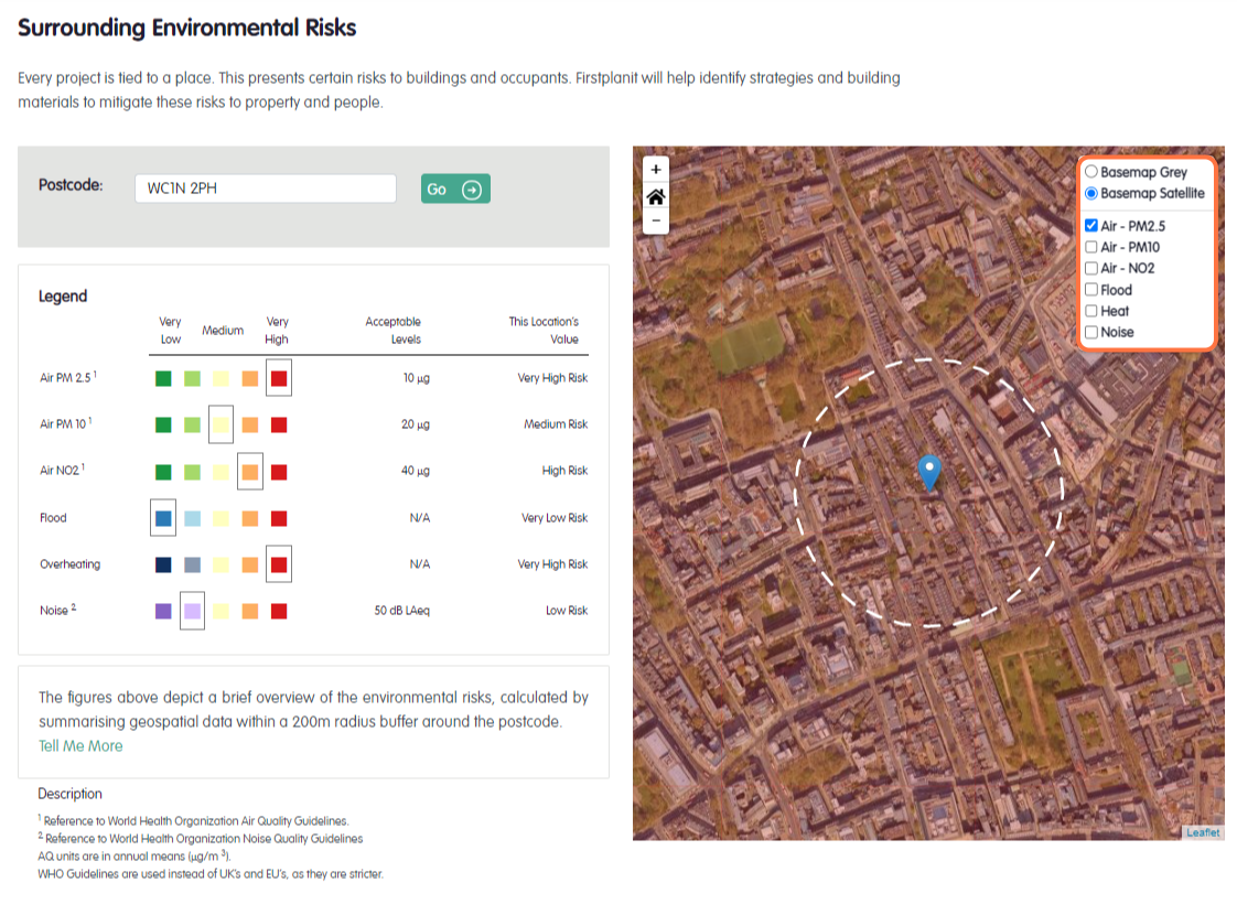
Select filters on the map to add layers that highlight the impact of each risk. You can apply multiple layers to gain a holistic understanding of the site’s risks.
Step 5
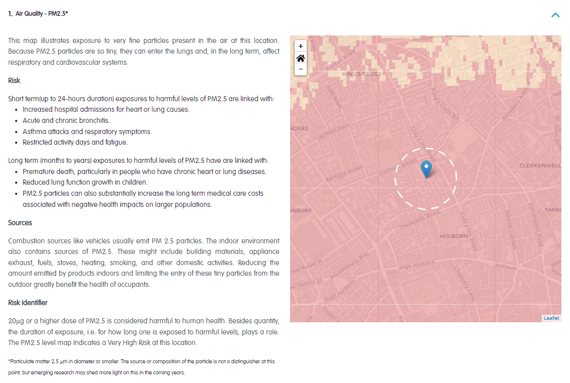
Scroll down the page and read the further details section for a deeper understanding of each risk. We provide information on the risk, the sources and the risk identifier. This information is available for, air quality PM2.5, air quality PM10, air quality NO2, flood potential, noise pollution, and overheating.
By following these steps, you can utilise our GIS powered feature to assess site risks for your project, and make informed decisions to minimise potential risks.
If you would like to learn more about Geographic Information Systems read our previous blog on this topic.